Nested in the Kinabalu National Park, the iconic Mount Kinabalu stands at 4,095 meters above sea level. Among the sought after mountains worldwide, Mount Kinabalu is among the most accessible, being just 90km away from the Kota Kinabalu City Centre, and strategically located enroute to several districts in Sabah; Kota Marudu, Sandakan, Tambunan to name a few.
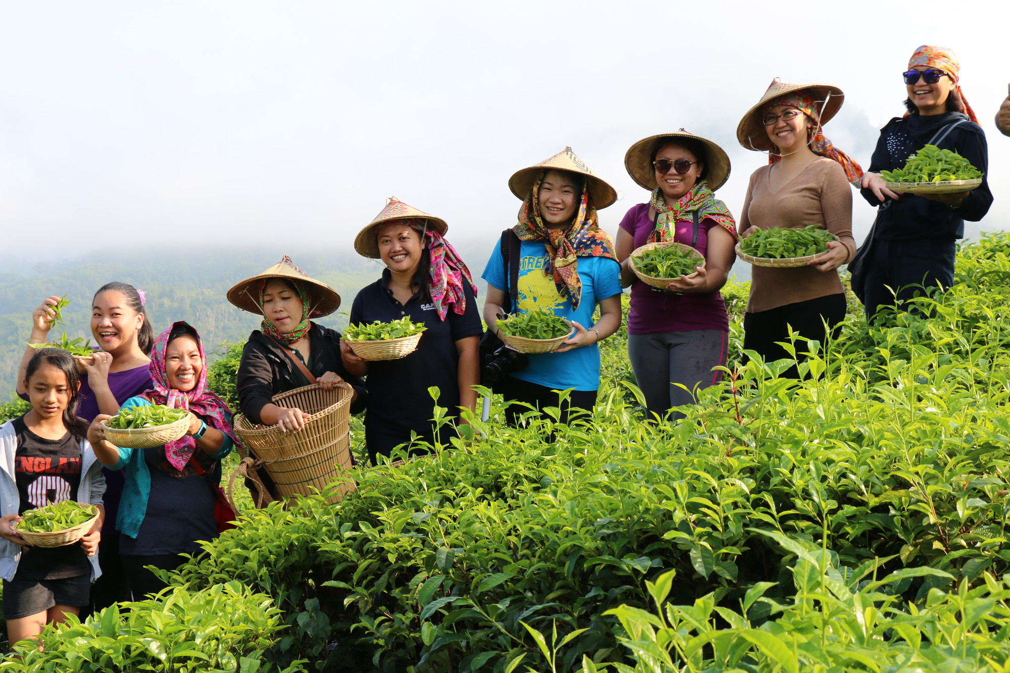
What is interesting about the landscape of Mount Kinabalu is its 6 levels of different vegetation. Now this may not be tremendously obvious to many, but for those keen on nature elements, would be able to tell the different vegetations at the respective altitudes, otherwise, the most obvious change comes after the Layang Layang Hut whereby the rocky alpine starts and bonsai plants keep you company for the last leg before reaching the Panar Laban area where you would rest before the summit ascend.
Taking on the Summit Trail.
The current quota of climbers per day is at 165 pax (however due to Covid-19, the number of permits is at 100 pax per day). Regardless if you are a single climber or in a group, it is advisable to book ahead.
Before you start your journey regardless of which trail you have chosen; Ranau Trail, Kota Belud Trail or Via Ferrata, all climbers will convene at the Kinabalu National Park Headquarters to get registration done, get your guides assigned and porters if you need such services. This occurs between 8am to 9am. You will then be transported to the Timpohon Gate where you will check in once again before starting the hike. If you did not book your tour via an agent, you could catch a ride from the shuttle van for a small fee.
The mountain guides… regardless of how many summits you have accomplished, the guide is not optional. For the Ranau Trail which is the common trail taken to the summit, the ratio is 1 guide for 5 climbers and for the Kota Belud Trail, it’s 1 guide for 3 climbers.
About the porter. He is not your guide. So he will pretty much take a good lead time with your bag and have it left at the hostel up at Panar Laban. So if you do opt for this service, do have a small carry on for your water, snacks and raincoat.
Now, you are at the Timpohon Gate, that’s where you will be snapping your first photo before the journey. A few meters away, you think to yourself, “man this trail is beauuuutiful. And what? A waterfall, how nice.” Second picture.
You are now coming to the sign post of KM2 or 3… the trail is getting a bit more intense by now (this is subjective to the climber, the admin is speaking on behalf of the unfit but brave team). Stop for a sip of water, don’t stop too long.
It’s only 6km from Timpohon to Panar Laban (not to be compared with your 10km marathon on flat land that you accomplished in 1hour 15minutes). Pace yourself on this trail and try to reach Panar Laban by 4pm or so.
You have now reached Panar Laban. You breath a sigh of relief that you have made it! 2.5km more to go because you can say “I made it up to Mount Kinabalu”. Wait a minute, get to your allocated lodging for the night. It’s usually between Laban Rata, Lemaing, Kinotoki or Mokodou Panalaban hostel. Meals though are served only at Laban Rata.
You will have your dinner between 4pm to 8pm and then snooze until about 1:00am as you rise in the shivering cold as you begin the 2nd leg of the journey. You will check in at the Sayat Sayat Checkpoint and from here on, the granite landscape is your route toward the Low’s Peak.
Now you have reached the Low’s Peak. Congratulations! Awesome job. We hope you enjoyed the climb. When they say, conquer Mount Kinabalu, it really should not be merely getting yourself up and down. But take the opportunity to embrace the journey. You will have a much better experience to take and share. How to prepare well? Training is essential, but if you did not do much, take it on with a mind over matter attitude.
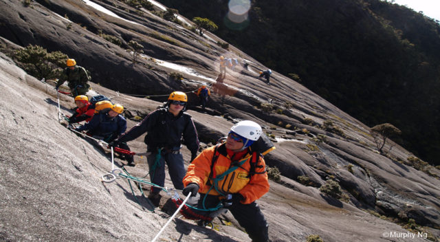
You have come across the Kota Belud Trail and Via Ferrata earlier in this entry. We’ll elaborate more on the KB Trail here, whereas, click off for the Via Ferrata.
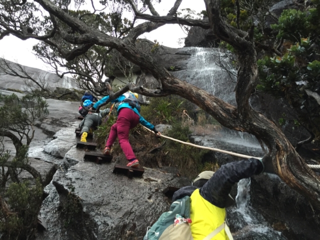
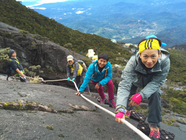
The Kota Belud trail is also managed by Sabah Parks alike the Ranau trail. It is a completely different experience, and one would definitely require a higher level of fitness to take on the 1.1km trail that also meets at the Sayat Sayat Checkpoint. You will be using more ropes to assist your ascend and sectional parts with some wooden steps. You will require permission from Sabah Parks to take on this trail.
Regardless of which trail you decide to take, make this trip a memorable one.
You should know:
If you reach the Low’s Peak, your certificate will be in full color
If you do not, your certificate will be in B&W
Malaysia’s Highest Post Box is located at the Pendant Hut. Buy a postcard from there or have them prepared but get it postmarked with their signature stamp.